Capacity of Flexibility: using space near or on Rotterdam’s waters
A study commissioned by the municipality of Rotterdam.
Proposing a methodology to evaluate an area’s responsiveness to changing urban functions using land and water spaces, this study selected three Rotterdam neighborhoods and developed a toolbox with a Time Space Index to determine suitable urban function categories. Using a script, the program distribution was optimized, and Iris Scan and maps were produced to aid investors in deciding where to develop for a given function at a specific location. This research provides a foundation for further studies to enhance the methodology.
Urban areas are constantly changing, and it is essential to understand their capacity to respond to new demands from an investment perspective. In this regard, unused land spaces and water areas can significantly improve an area’s responsiveness. In Rotterdam, the municipality initiated a research project to explore the potential of water spaces in enhancing an area’s responsiveness. The study aims to identify the capacity of a given area to host new urban functions that may arise in the near future, considering both land and water spaces.
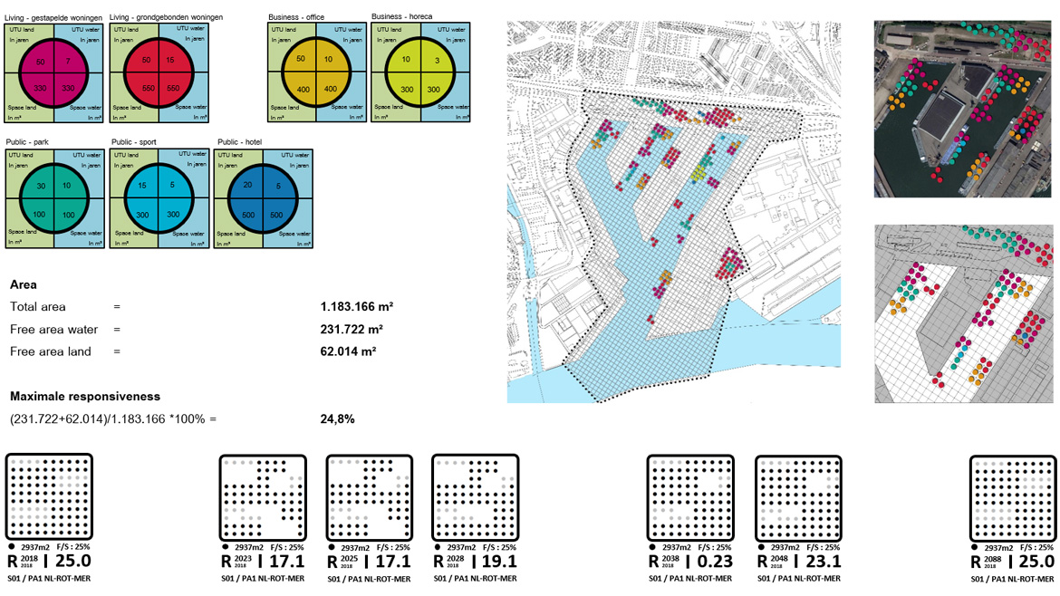
The research project identified three neighborhoods in Rotterdam: Merwehaven, Bospolder/Tussendijken, and Prins Alexander Polder, and three categories of urban functions: business, housing, and public spaces. A toolbox was developed, incorporating a Time Space Index to identify which programs could be added. The Time Space Index expresses the minimum return period in years for a given function category and the required space needed.
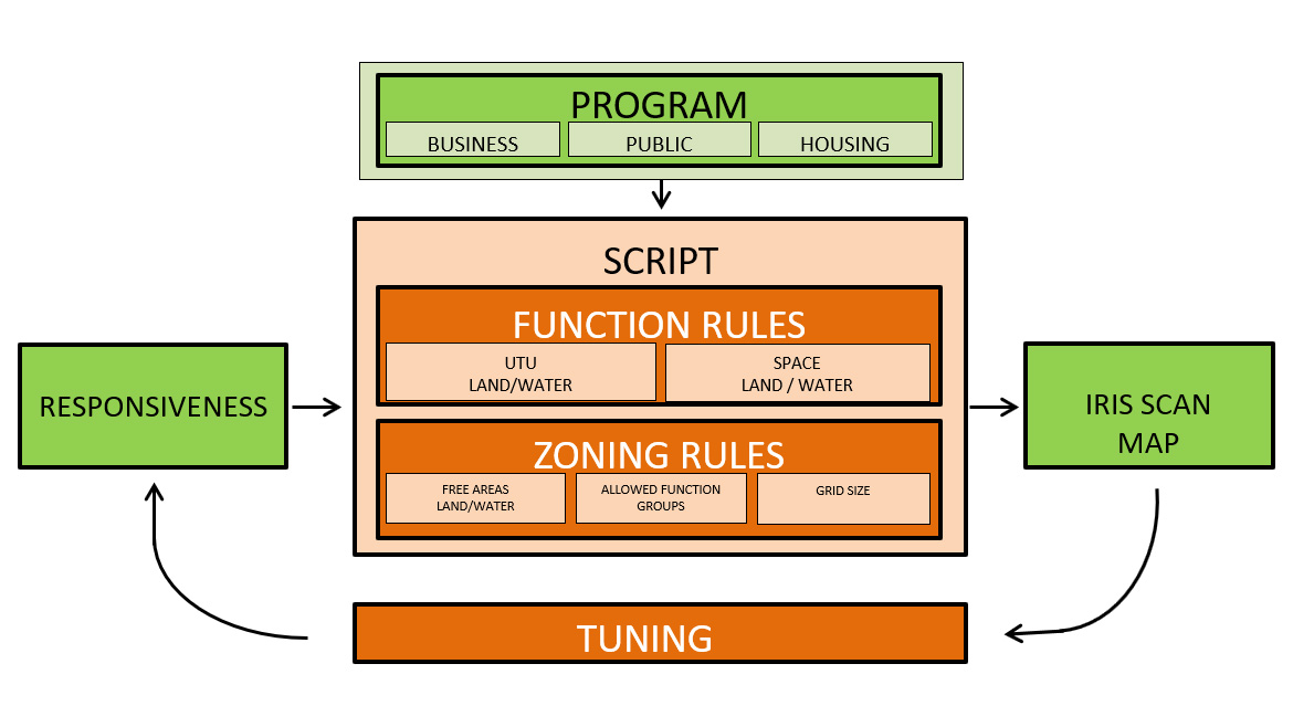
To implement the research, the study collected Geographic Information System (GIS) data for the three neighborhoods, including urban structure and functions, available land and water spaces, and water body characteristics. A script was developed in Grasshopper software, which first distributes the urban functions categories over the available spaces in a given neighborhood. Subsequent iterations optimize the distribution of land and water spaces to improve the responsiveness of the initial results.
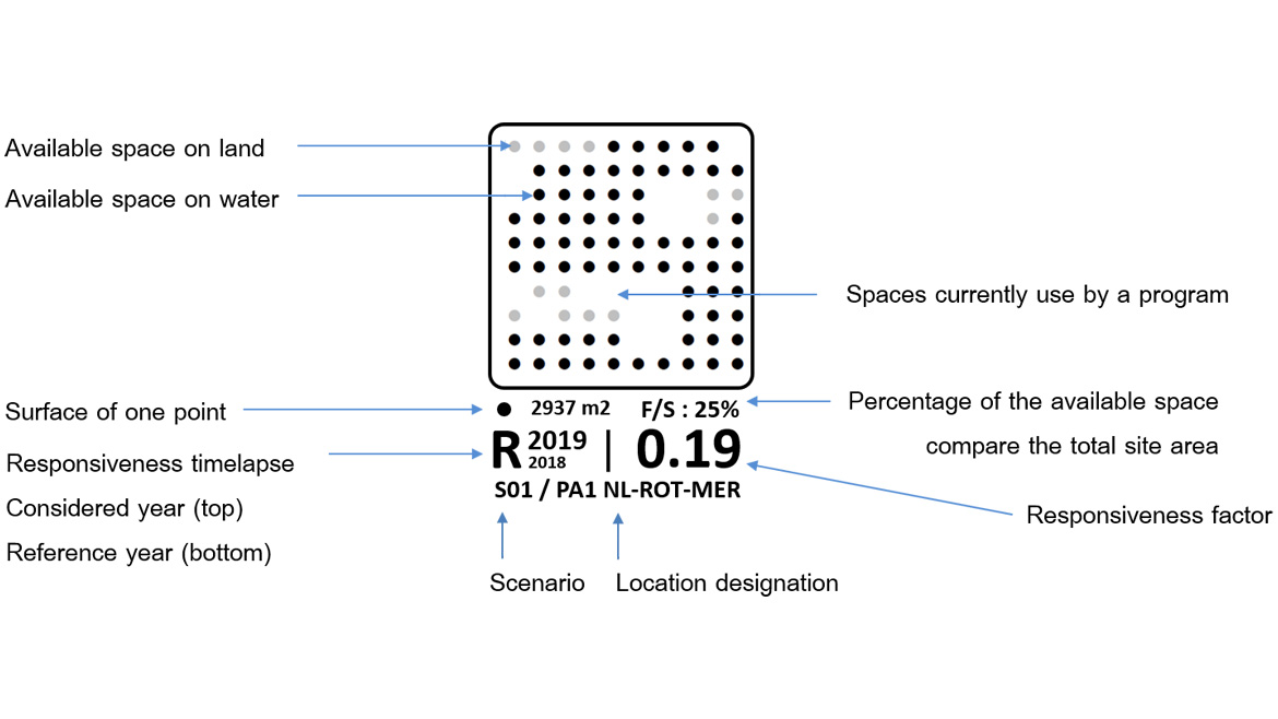
The study presents an Iris Scan, a schematic representation of the available spaces in a given time frame compared to the starting year. This representation helps investors identify where to develop on land and where to develop on the water for a given function at a given location.
In conclusion, the study serves as a basis for a method that provides investors with a tool to decide where to invest in land and water spaces for a given urban function at a particular location. However, further studies and additional data will be necessary to improve the effectiveness of this method.